Geotrailing with Live Search Mobile
On many domestic and international flights you can see on the TV monitor the gradual progress of the plane as it moves little by little across a map of the world. Out of curiosity, I wanted to know whether you can do something similar with my HTC Trinity phone, using the GPS facility to make a visual record with aerial photos of a route as I was taking it. I didn't have any particular purpose in mind, though I thought that to start I should try out something locally, in Oxford.
I'm still new to GPS and so far had largely just used it to plot a basic trail of GPS co-ordinates and take a few photos recording such details as EXIF data. However, I was soon introduced to mobile mapping software, notably Map24 Mobile , Google Maps Mobile and Microsoft Live Search for mobile devices. Google Maps and Live search both make use of satellite photos and can communicate with GPS receivers, so both looked promising candidates. So which one to choose? They makes use of different satellite data and in some areas Google has higher resolution photos and vice versa. In the case of Oxford, the Microsoft offering has far more detailed images, so I gave Live Search a go.
It sounds relatively simple - assuming you can get a GPS lock on your current location, you just need to ensure that maps are available as you go wandering. The mobile tools helpfully have cache facilities and I set Windows Live to its maximum of 8MB storage and started tracing a route in advance. However, care is needed about the areas you record and the zoom level - start off in the wrong area and/or wrong zoom and you might not see anything! To be safe, at least for a novice navigator like myself, I think you need to have Net access on demand. In the UK there's a good offer for general Net usage called 'Web n walk' available from T-Mobile . I took advantage of the free pay as you go SIM offer. There is very good coverage in Oxford, even for HSDPA
However, as far as I can tell the mapping software don't record your progress, they do not 'film' the steps you make or the path that unfolds, so I needed to find a screen recording utility. I had already made use of some screen capture tools such as Pocket Screen Capture to take snapshots of individual screens, but here I needed to find something that could conveniently record a sequence. Initially, all I could find were tools that required a connection with a desktop PC, which would use a remote viewer in conjunction with screen capture facilities on the PC itself. However, that wouldn't be much use on my travels (unless I wanted to lug a laptop with me!) After a while, I came across an excellent survey by Werner Ruotsalainen, who maintains an informative blog for Smartphone & Pocket PC Magazine.
It was through this survey that I found SuperSnap and in the quick tests that I set it worked exceedingly well, so I bought a copy.
Thus I was all set and yesterday provided a great opportunity to give it a whirl - a day out to Great Malvern to go walking on the hills :-) I set off and headed towards the canal, but indications pointed to some obstacles...
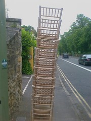
Undaunted I made my way and got to the canal and after some fiddling about, managed to get a GPS lock, connect, and start recording ... et voilà!

If you click on the image then it should load the animation on top (will need to wait a while as it is 700K file), but if that doesn't work, you can view the animation separately.
So why did I opt for SuperSnap? Well, apart from having a timer and allowing you to save as BMP or JPEG (variable compression), it has a special function that takes a copy of the screen every time it changes and it appears to do this cleanly and efficiently, fast enough for multiple updates a second. At work, I can see that it will be ideal for recording screens for instructions on using various software, setting configurations etc. I think it's well worth the $9.95 price tag.
However, the sequence is captured as a series of individual files and there is no animation option. In order to produce an animation, I needed the assistance of my desktop PC (bit disappointing for a mobile enthusiast ;-) I used Irfanview to do a batch conversion to GIFs and then imported them into MS GIF Animator, a rather old package that used to come with MS Frontpage 98!
Ideally, I would like to see a couple of other options introduced in SuperSnap - the first is an option to save screens as GIFs, though I expect its viability depends upon the amount of processing overhead and secondly, an option to export sequences as some animation or video file, but perhaps that is being rather too optimistic :-)I subsequently tried the same activity on the train and it was good, as far as it went... just a few metres down the track and I lost the GPS lock, a little further down the line and the connection was no longer HSDPA or 3G, but GPRS. There's evidently some way to go before it becomes simple and dependable. Even so, it works in principle and I'm sure it'll be commonplace soon.
Labels: aerial view, geotrail, GPS, live search, mobile
posted by Paul Trafford at 11:13 am
![]()

0 Comments:
Post a Comment
<< Home