Sunday, April 22, 2007

On the trail of a noble Spoon

Having discovered my bearings with the enabling of HTC Trinity's GPS receiver, I decided to explore a little more what the device could do.

My first significant experiment was to use with the aid of VisualGPSCE log a train journey from Oxford to Worcester and beyond. Similarly I logged another journey in Worcestershire - a visit to Chaddesley Wood to see if the bluebells were starting to appear (there were some signs, but not yet a profusion of colour). VisualGPSCE records data in a standard GPS log file. From my PDA I uploaded the output to GPS Visualizer, which is a sophisticated online service that can overlay your data on Google Maps or even embed in 3D in Google Earth. I initially tried to generate a Google hybrid map but Pocket IE couldn't render it, so I next chose to simple output in the form of a JPEG:

The track is coloured (ranging from red through the colours of the rainbow to magenta) according to altitude or speed - looking at the track, I think it has indicated speed. I also logged a track in the woods and took a few photos during this time. Provided the camera and GPS clock are reasonably in sync, you can faithfully combine the path data with the images taken from the camera, i.e. geotagging the images. It's again a new area for me so I don't yet know many options, though the Robogeo site lists a number of techniques (as well as offers its software) to solve the problem.

However, an easier solution is for the camera to record GPS details with the photo and as it happens the HTC does indeed have this ability: I entered "HTC P3600 EXIF" into Google and landed on the info I needed to know on Erwin van Hunen's Mobile Viking blog. Indeed, with the ROM upgrade, there has been some enhancement of the camera software, Camera for Pocket PC, now is at Version 4.02. If you access the camera settings and paddle along to settings for Capture Mode and navigating down the menu, at the bottom is the option for 'GPS Photo'. Once you've selected that, then when you come to take a photo the centre of the screen greys out and a message reads 'Initializing GPS...' As that is all it says, on switching on I tend to establish a connection and lock with VisualGPSCE and once I've got a lock I then switch over to the camera, which initializes very quickly.

From then on it's as easy as taking normal photos - I didn't notice any difference in the speed to take snaps. Camera data is stored in EXIF format and GPS details get added - the GPS version ID plus longitude, latitude and time. Ah, on looking a bit more closely, I see that the GPS system has atomic clock time and my PDA is about 1 minute fast! (I now have fixed that manually, but I wonder if there is a nice simple sync utility for the mobile?)

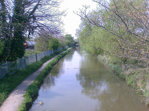
You may be wondering at this stage what the title is about! Well, it's meant to be a very easy little mystery tour - where did I go? I was on the way to visit a large wooden family, somewhere in the city of Oxford. I took a stroll along the canal, keeping a GPS log. I started somewhere in Northern part and took the following photo (click for essential information!)

The Oxford canal at Wolvercote

About 2 miles down the canal I crossed a footbridge and then took a zigzag route, walking for a further 10 minutes or so towards the centre. I passed a legal publishers and a few hundred metres on as I approached my destination it was getting busier with tourists. I then took a left turn and entered a large building, descended some steps and met the family:

But there was one Spoon I was particularly interested to meet and here he was:

But who was he and where was I? You can click on the link to find out and confirm!

[As part of Oxfordshire's 1000 Years celebration, a collective work of art has been created through the transformation of 1000 wooden spoons. It's called the Spoon Race .]

I hope you enjoyed today's GPS journey :-)

Thursday, April 05, 2007

No excuses for getting lost with HTC P3600 ROM Upgrade :-)

As mentioned in my previous post on PDA and phone convergence, the HTC P3600 that I purchased has in its circuit board a GPS receiver, but it was not enabled in my version of the phone. During the past weeks I had been scouring the Web for signs of an official ROM update that might include this. The Asian version (for the Dopod equivalent) had been released in February, but the European version was slow to emerge until news spread via sites like XDA Developers of the official WorldWide English (WWE) release becoming available in a few countries such as Belgium, Sweden and then Italy.

So where was the ROM for UK users? It was a bit odd - I had read of people's queries to their HTC sellers with generally noncommittal responses. Wanting some clarification of the situation, on Tuesday (3rd) I got in touch with Smartphones Direct, the company that had sold me my phone, using their Java-based online chat facility. I asked about the availability of the HTC Rom update to include GPS and at that time was informed that it wasn't available and that even an official ROM download would invalidate the warranty, but there was the possibility of the company installing it for me for a fee.

Disappointed, I was wondering what to do. However, I kept dipping into online fora and the next day I was encouraged by a thread on the Expansys site. It was great news - an official ROM to download from HTC Europe's site. I proceeded to download and was expecting to install straightaway, but I hit a snag - I had left the sync cable in the office and the next day I was on leave and due to be travelling in the afternoon! Never mind. This morning I popped into the office, collected the cable en route to a bit of shopping, then raced back home and carried out the upgrade and it was fine.

Naturally, I was keen to try out the GPS. I see they have since added TomTom Navigator as a freebie, but I was travelling by train this afternoon, so instead I installed VisualGSPCE. Having never used GPS before, I don't know what to expect, but I find this a very nice piece of software that is easy to use and provides very clear details of your co-ordinates (longitude and latitude are very accurate, but altitude seems to fluctuate quite a bit more) plus your velocity. It also shows some stats about the satellites - how many around, how many are being used (have strong enough signal). After installation, I found I needed to do a restart of the PDA and initially it gave an error because by default it was expecting communications to be on COM1; changing (via the app) to COM9 enables it to work. From then on it's a doddle!

My colleague Matthew had alerted me to an article in The Register in which they had tested the GPS in the Orange SPV M700 (rebadged HTC P3600) and they had found it drained the battery as much as talk time, i.e. to about 4.5 hours. One of my other colleagues has the Orange phone and had already tried the GPS; I haven't got round to asking him about battery life, but I think his ROM is dated January and since then I've read very positive remarks about improvements in this area in later ROMs (the HTC WWE one is from March).

So I ran a test. Just before my train arrived I switched on the phone, got a lock (within a minute) and left it on for the duration of the journey. VisualGPSce has a logging facility, which I remembered to switch on just after we had left the station. I then kept the PDA on (with non-backlit display) for the duration of the journey, which was 3 1/4 hours. So did it last the distance? At the start it was at 90% and by the end of that period, it had 50% battery left, which means only about 40% was used in that duration, which also included 3 quick calls and a 1 minute video shoot. All in all, quite impressive, I think!

There are quite a number of features in the ROM Upgrade that are worthy of mention, including support for receiving streaming video. However, now at my destination, I have about 2MB of GPS log to peruse... :-)

Labels: , , , , ,